Being the Río de la Plata a micro-tidal scenario the meteorological tide has prominent influence over it. Wind surges cause floods and inversions in the astronomic behavior of tidal currents as well.
In this section we compare the model results with real data in occasion of a storm surge of 12-day long. This simulation took 10 hours employing the Tidal code and only 2.5 hours using PTidal program.
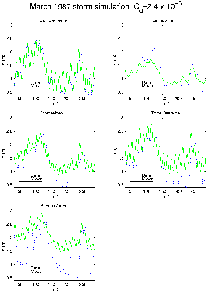
Figure 8.9 compares calculated against measured levels during a typical Río de la Plata wind storm, with predominating S-SW winds of 50 km/h and up to 60 km/h. The simulation start date corresponds to March 5, 1987. Note the high water elevation which significantly exceeds the mean levels (compare to figure 8.4) and dominates over the astronomic tide amplitud.
Hourly wind data is taken from the measurement stations in Carrasco Airport (Montevideo, Uruguay), La Paloma (Uruguay) and Aeroparque (Buenos Aires, Argentina). A bilinear interpolation, and extrapolation, into the grid points is performed as long as a linear interpolation in time.
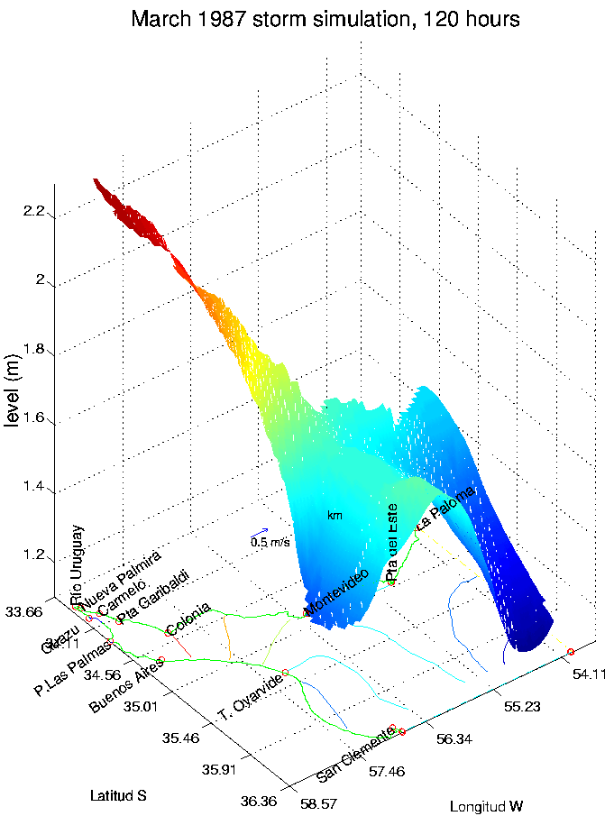
Figure 8.10 shows a 3D view of the water level corresponding to March 9, 12 P.M. (after 120 hours of simulation, see figure 8.9) when the levels across Río de la Plata reached its maximum. Compare them with the normal astronomic behavior present in figure 8.8 and note the high increase in the levels along all the domain and mainly in its upper part.
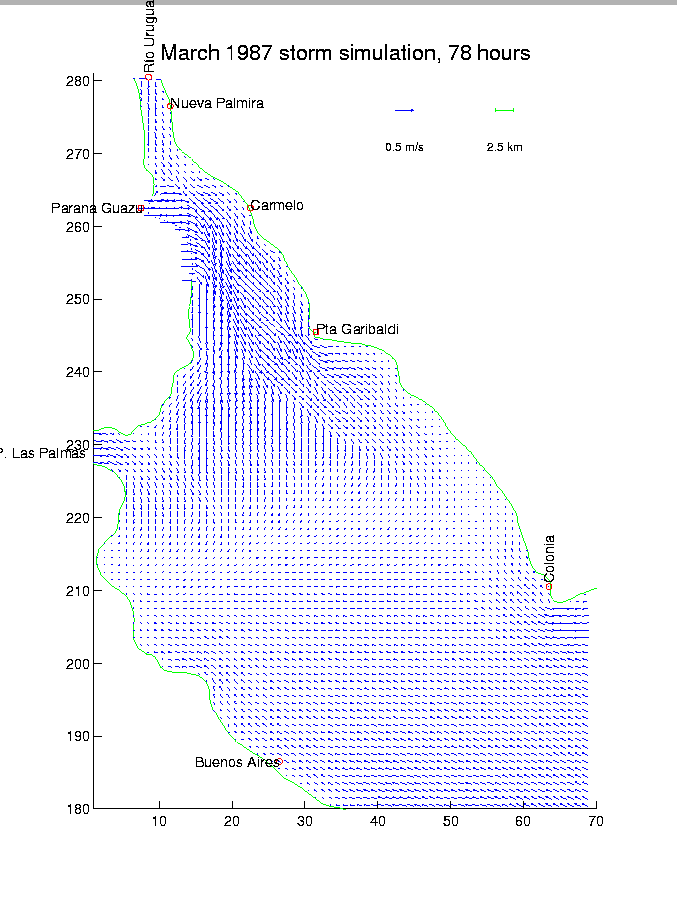
Figure 8.11 represents the velocity field after 78 hours of simulation, March 7, 6 A.M., when the winds reached their maximum strength. Pay attention to the speed overall behavior, specially in front of Colonia, with the water entering to the upper section.
Compare to the astronomic water speed behavior in a corresponding time, area around Colonia in low-tide like in figure 8.1, with the currents leaving the area. This inversion of the speeds behavior, caused by the strong South winds, highlights the prominent importance of the meteorological tide over the Río de la Plata.
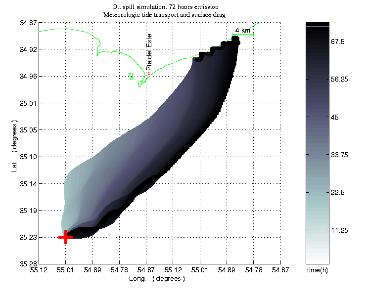
To illustrate one of the many PTidal uses we simulated a real oil spill incident occurred on February, 1997. Figure 8.12 presents preliminary results of a meteorological simulation, applied in conjunction with a surface transport model, simulating the oil spill evolution. Results of the modeling are in qualitative accordance with the observed effects on the coast. A similar simulation, but neglecting the meteorological tide effects, have shown completely different results, with the oil reaching the coast to the West of Punta del Este.